Showing posts with label GeoAI. Show all posts

Tuesday, April 30, 2024

Presentations at the AAG


At the recent American Association of Geographers (AAG) Annual Meeting in Honolulu, Hawaii, our group had several presentations showcasing some of the research we are doing here at the University at Buffalo with respect to agent-based modeling, social media analysis and machine learning. If these sound of interest feel free to reach out to us to find out more. 

First up was Na (Richard) Jiang who presented a paper entitled "Populating Digital Twins with Humans: A Framework Utilizing Artificial Agents". In this presentation he showcase our workflow of embedding agents in models of cities using examples from simple commuting models (like that shown below) to the spread of diseases.

Abstract
Over the last few decades, considerable efforts have been placed in creating digital virtual worlds. Ranging in applications from engineering, geography, industry, and translation. More recently, with the growth of computational resources and the explosion of spatial data sources (e.g., satellite imagery, aerial photos, and 3-dimensional urban data), creating detailed virtual urban environments or urban digital twins has become more widespread. However, these works emphasize on the physical infrastructure and built environment of the urban areas instead of considering the key element acting within the urban system, which are the humans. In this paper, we would like to remedy this by introducing a framework that utilizes agent-based modeling to add humans to such urban digital twins. Specifically, this framework consists of two major components: 1) synthetic population datasets generated with 2020 Census Data; and 2) pipeline of using the population datasets for agent-based modeling applications. To demonstrate the utility of this framework, we have chosen representative applications that showcase how digital twins can be created for study various urban phenomena. These include building evacuations, traffic congestion and disease transmission. By doing so, we believe this framework will benefit any modeler wishing to build an urban digital twin to explore complex urban issues with realistic populations.

Keywords: agent-based model, geosimulation, urban digital twins


Following this talk, I presented work on behalf of  Fuzhen Yin and Na (Richard) Jiang  entitled "Modeling Covid Vaccination uptake in New York State: An agent-based modeling perspective". In this paper we utilize Richards workflow and add social media networks to it in order to explore vaccination uptake for the whole of New York state. We do this through the lens of opinion dynamics and agent-based modeling, in the sense how people may change their opinions about wether or not to get vaccinated based on information from different sources (e.g. family, friends or online).   

Abstract
The effect of the recent COVID pandemic has been significantly curtailed with the introduction of vaccinations. However, not everyone has been vaccinated for a multitude of reasons. For example, people might be influenced by what they read online or the opinions of others. To explore the changes in people’s views on vaccination, we have developed a geographically explicit agent-based model utilizing opinion dynamics. The model captures people’s opinions on COVID vaccination and how this relates to actual vaccination trends. Using the entire state of New York with a population of over 22 million agents, we model vaccination uptake from January 1, 2021, until May 15, 2022. Agents within the model synthesize information from the other agents they are connected with either in physical or cyberspace and decide whether to vaccinate or not. We compare these vaccination statuses among different age groups with actual vaccination rates provided by New York State. Our results suggest that there is an interplay between different spaces and ages when it comes to agents making a decision to vaccinate or not. As such the model offers a novel way to explore vacation decisions from the bottom up.
Keywords: Agent-based modeling, Covid, Vaccine, Geosimulation, Social Networks


Ofter this,  Qingqing Chen presented work with Ate Poorthuis and myself entitled "Mapping the Invisible: Decoding Perceived Urban Smells through Geosocial Media in New York City" in which we explore how social media can be used to map smells in large metropolitan areas. 

Abstract
Smells can shape people’s perceptions of urban spaces, influencing how individuals relate themselves to the environment both physically and emotionally. Although the urban environment has long been conceived as a multisensory experience, research has mainly focused on the visual dimension, leaving smell largely understudied. This paper aims to construct a flexible and efficient bottom-up framework for capturing and classifying perceived urban smells from individuals based on geosocial media data. Thus, increasing our understanding of this relatively neglected sensory dimension in urban studies. We take New York City as a case study and decode perceived smells by teasing out specific smell-related indicator words through text mining and network analysis techniques from a historical set of geosocial media data (i.e., Twitter). The dataset consists of over 56 million data points sent by more than 3.2 million users. The results demonstrate that this approach, which combines quantitative analysis with qualitative insights, can not only reveal “hidden” places with clear spatial smell patterns, but also capture elusive smells that may otherwise be overlooked. By making perceived smells measurable and visible, we can gain a more nuanced understanding of smellscapes and people’s sensory experiences within the urban environment. Overall, we hope our study opens up new possibilities for understanding urban spaces through an olfactory lens and, more broadly, multi-sensory urban experience research.

Keywords: Smellscape, Urban smells, Geosocial media, Text mining, Network analysis, Multi-sensory urban experiences.

Last but not least,  Boyu Wang presented his work entitled "Simulating urban flows with geographically explicit synthetic populations".  In this talk, Boyu showed how a deep learning spatial-temporal urban flow model is trained to predict the aggregated inflows and outflows within regions and feed directly into an agent-based model.

Abstract

Urban human mobility is an active research field that studies movement patterns in urban areas at both the individual and aggregated population levels. Through individual’s movement, higher level phenomena such as traffic congestion and disease outbreaks emerge. Understanding how and why people move around a city plays an important role in urban planning, traffic control, and public health. An abundance of agent-based models have been built by researchers to simulate human movements in cities and are often integrated with a GIS component to realistically represent the study area. In this work we build a geographically explicit agent-based model where agents move between their home and workplaces, to simulate people’s daily commuting patterns within a city. In order to build this model, we develop a geographically explicit synthetic population based on census data. A deep learning spatial-temporal urban flow model is trained to predict the aggregated inflows and outflows within regions of the study area, which are subsequently used to drive individual agents’ movements. To validate results from the agent-based model, agents’ movements are aggregated and evaluated along with the urban flow model. Commuting statistics are also collected and compared to existing travel surveys. As such we aim to demonstrate how urban simulation models can be complemented by recent advancements in GeoAI techniques. Conversely, the aggregated deep learning model predictions can be investigated at a fine-grained individual level. This extends traffic patterns forecasting from just looking at the patterns to the processes that lead to these patterns emerging.

Keywords: Agent-Based Modeling, Urban Flow, GeoAI, Urban Simulation, Synthetic Populations 

References

Yin, F., Jiang., N. and Crooks, A.T. (2024), Modeling Covid Vaccination uptake in New York State: An Agent-based Modeling Perspective, The Association of American Geographers (AAG) Annual Meeting, 23rd –27th April, Honolulu, HI. (pdf)

Jiang., N. Crooks, A.T., Wang, B. and Yin (2024), Populating Digital Twins with Humans: A Framework Utilizing Artificial Agents, The Association of American Geographers (AAG) Annual Meeting, 23rd –27th April, Honolulu, HI. (pdf)

Chen, C., Poorthuis, A. and Crooks, A.T. (2024), Mapping the Invisible: Decoding Perceived Urban Smells through Geosocial Media in New York City, The Association of American Geographers (AAG) Annual Meeting, 23rd –27th April, Honolulu, HI. (pdf)

Wang, B. and Crooks, A.T. (2024), Simulating Urban Flows with Geographically Explicit Synthetic Populations, The Association of American Geographers (AAG) Annual Meeting, 23rd –27th April, Honolulu, HI. (pdf)

Wednesday, March 22, 2023

AAG 2023 Presentations

At this years Association of American Geographers (AAG) Annual Meeting we have a number of presentations ranging from how one can leverage newspaper articles to study cities over time, to that of how people may chose to become vaccinated. These presentations build on the great work of students and postdocs here at the University at Buffalo and link to our interests in urban analytics, machine learning and agent-based modeling. Below we just give a glimpse at these topics (along with their abstracts) and if you are interested in finding out more please reach out to us.

First up is a presentation with Qingqing Chen and Boyu Wang entitled "Community resilience to wildfires: A network analysis approach utilizing human mobility data."  In this presentation we explore how we can quantify a communities resilience to wildfires utilizing human mobility through network analysis methods. 

Abstract 

Natural disasters, such as earthquakes, floods, and wildfires, have been a long-standing concern to societies at large. With growing attention being paid to sustainable and resilient communities, such concern has been brought to the forefront of resilience studies. However, the definition of disaster resilience is intricate and can vary across the diverse disciplines that study them (e.g., geography, sociology and political science), making its definition and quantification elusive. Moreover, the vast majority of studies often focus on the immediate response to an event, not the long-term recovery of the area impacted by disasters. Thus to date investigating the resilience of an area or a society over a prolonged period of time has remained largely unexplored. To overcome these issues, we propose a novel approach from a social perspective utilizing network analysis and concepts from disaster science (e.g., the resilience triangle) to quantify the long-term impacts of wildfires, especially on collective human behavior. Taking the Camp and Mendocino Complex wildfires - the most deadly and the largest complex wildfires in California to date, respectively - as case studies, we capture the features of resilience, such as robustness and vulnerability, of communities based on human mobility data from 2018 to 2020. The results show that demographic and socioeconomic characteristics alone only partially capture community resilience, however, by leveraging human mobility data and network analysis techniques, we can enhance our understanding of resilience over space and time, which can provide a new lens to study natural disasters and their long-term impacts on society.

Keywords: Community Resilience, Natural Disasters, Wildfires, Social Network Analysis, Human Mobility, Space and Time.

Full Reference

Chen, Q., Wang, B. and Crooks, A.T. (2023), Community Resilience to Wildfires: A Network Analysis Approach Utilizing Human Mobility Data, The Association of American Geographers (AAG) Annual Meeting, 23rd –27th March, Denver, CO. (pdf)

Next up, moving from mobility to textural data, specifically that of newspapers Na (Richard) Jiang and myself have a presentation entitled "Leveraging Newspapers to Understand Urban Issues: A Longitudinal Analysis of Urban Shrinkage in Detroit". In this work we explore how can leverage Bertopic (a topic modeling technique) on newspaper articles spanning the years 1975 to 2021 to explore urban shrinkage in Detroit. 


Abstract 

Today we are awash with data especially when it comes to studying cities from a diverse data ecosystem ranging from demographic to that of remotely sensed imagery and social media. This has led to the growth of geographical data science and urban analytics providing new ways to conduct quantitative research within cities. One area that has seen significant growth is that of using natural language processing techniques on text data from social media to explore various issues relating to urban morphology. However, social media only provides limited insights when dealing with longer-term urban phenomena, such as the growth and shrinkage of cities. This relates to the fact that social media is a relatively recent phenomenon compared to more longer-term urban problems that take decades to emerge. With respect to the longer-term coverage, newspapers which are increasingly becoming digitized provide the possibility to overcome the limitations of social media and provide insights over a timeframe that social media does not. To demonstrate the utilization of newspapers within urban analytics and to study longer-term urban issues, we present an advanced topic modeling technique (i.e., Bertopic) on a large number of newspaper articles spanning the years 1975 to 2021 to explore urban shrinkage in Detroit. Our topic modeling results reveal the insights related to Detroit's shrinkage can be linked to the side effects of economic recessions on Detroit's automobile industry, local employment status, and the housing market. As such, this work demonstrates the potential of utilizing newspaper articles to study long-term issues

Keywords: Natural Language Processing, Topic Modeling, Newspapers, Text Data, Urban Shrinkage, Urban Analytics. 

 Full Reference

Jiang, N., and Crooks A.T. (2023), Leveraging Newspapers to Understand Urban Issues: A Longitudinal Analysis of Urban Shrinkage in Detroit, The Association of American Geographers (AAG) Annual Meeting, 23rd –27th March, Denver, CO. (pdf)

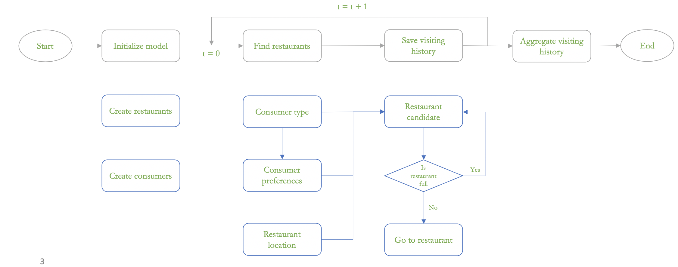
Switching gears slightly, we have another presentation that leverages text data, in this case Yelp reviews to help inform decision making within an agent-based model. This presentation with Boyu Wang is entitled "Do people care about others' opinions of places? Utilizing crowdsourced data and deep learning to model peoples’ review patterns."  We use a geospatial artificial intelligence (GeoAI) technique called aspect-based sentiment analysis to extract and categorize reviewers' opinion aspects on places within urban areas and then use this information to inform an agent-based model of peoples choices to which restaurants to go to.


Abstract  

People's opinions are one of the defining factors that turn spaces into meaningful places. While these opinions are subject to individual differences, they can also be influenced by the opinions from others. Online platforms such as Yelp allow users to publish their reviews on businesses. To understand reviewers' opinion formation processes and the emergent patterns of published opinions, we utilize geospatial artificial intelligence (GeoAI) techniques especially that of aspect-based sentiment analysis methods (a deep learning approach) on a geographically explicit Yelp dataset to extract and categorize reviewers' opinion aspects on places within urban areas. Such data is then used as a basis to inform an agent-based model, where reviewers' (i.e., agents') opinions are characterized by opinion dynamics. The parameters of these models are calibrated using extracted opinion aspects from the Yelp dataset. Such a method moves opinion dynamics models away from theoretical concepts to a more data-driven approach, with a specific emphasis being made on place. Focusing on 10 US metropolitan areas which are spread out across the country, we examine the calibrated influence coefficients for each opinion aspect category (e.g., location, experience, service), to compare reviewers' opinion formation processes across different categories. The results show the emergent patterns of reviewers' opinions and the influence of these opinions on others. As such this work demonstrates how using deep learning techniques on geospatial data can help advance our understanding of place and cities more generally.

Keywords: Agent-Based Modeling, Crowdsourcing, Deep Learning, GeoAI, Opinion Dynamics, Urban Analytics

Full Reference

Wang, B. and Crooks, A.T. (2023), Do People Care About Others' Opinions of Places? Utilizing Crowdsourced Data and Deep Learning to Model Peoples’ Review Patterns, The Association of American Geographers (AAG) Annual Meeting, 23rd –27th March, Denver, CO. (pdf)
Following with the agent-based modeling theme, our final presentation with Fuzhen Yin and Li Yin is entitled "How Information Propagation in Physical, Relational and Cyber Spaces Affects Covid-19 Vaccine Uptake: Evidence from Rural Areas." In this work we explore how people may or not be influenced by others (in physical, relational and cyber spaces) with respect to vaccination uptake.


Abstract 
With the advent of information and communication technologies, human dynamics studied in a purely physical space increasingly shift to a cyber and relational context. While researchers increasingly recognize the shift and call for attention to the multi-dimensionality of human dynamics (e.g., Splatial framework). Rarely have studies investigated how the information propagated in hybrid spaces affects people’s decision-making process, such as Covid-19 vaccine uptake. Meanwhile, compared to the urban population, the rural population faces greater digital barriers and has been further left out in human dynamics research. To fill this gap, our study investigates Covid-19 vaccine uptake in a rural county (i.e., Chautauqua) in New York State through agent-based modeling. We first generated a synthetic population to match the demographic characteristics of the census data. Then we created home, work, school, and social media networks to represent hybrid spaces. We defined the opinion dynamics of agents based on the social influence network theory. Next, we calibrated and validated our agent-based model based on real-world vaccine update records. Our research helps to elucidate the information propagation mechanism in hybrid spaces and clarify the decision-making process in the digital age. Furthermore, our method can also shed light on how to overcome data limitations for under-represented populations such as those who live in rural areas.

Keywords: Agent-based modeling, Covid-19, Vaccination, Opinion dynamics, Urban informatics, Rural geography

Full Reference 
Yin, F., Crooks, A.T. and Yin, L. (2023), How Information Propagation in Physical, Relational and Cyber Spaces Affects Covid-19 Vaccine Uptake: Evidence from Rural County, The Association of American Geographers (AAG) Annual Meeting, 23rd –27th March, Denver, CO. (pdf)